To meet the needs of Executives and Operations staff the Wayfinder Operations and Oceanography teams generate post-voyage analysis reports. This example compares two potential routes along the voyage and the final outcome of our decision. In this case, the coastal route with lower wave heights was chosen over the original voyage plan. Making this change saved the shipping company 35 MT in fuel and $10,000, though it did come at the cost of lost time. Both the software and our team must weigh these conflicting priorities as they can sometimes be at odds with one another. Options are considered carefully and in open conversation with Ship Captains and Shoreside Operators.
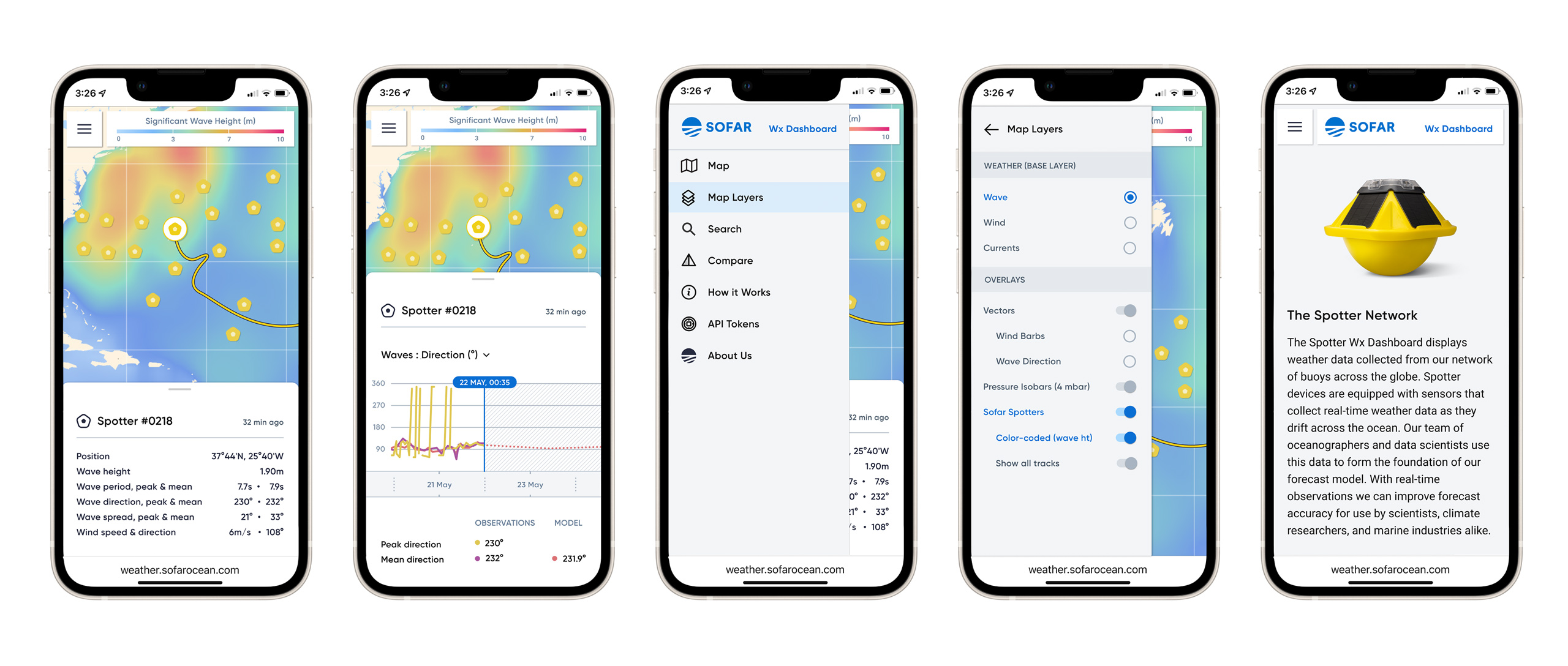
To support the scientific community and the general public, Sofar makes their Spotter data available online at
weather.sofarocean.com. The website below shows the location of all Spotters globally, and compares real-time observations to Sofar's forecast model.